
")


April 8, 2016—Aldever Resources Inc. (ALD—TSXV) (ALDVF—OTCQB) (17G1—Frankfurt) (“Aldever” or (the “Company”) is pleased to announce that it has completed its phase one geophysics and prospecting program on the Lac Villebon Gold Project (“the Project”), located in the Val-d’Or mining camp, Quebec.
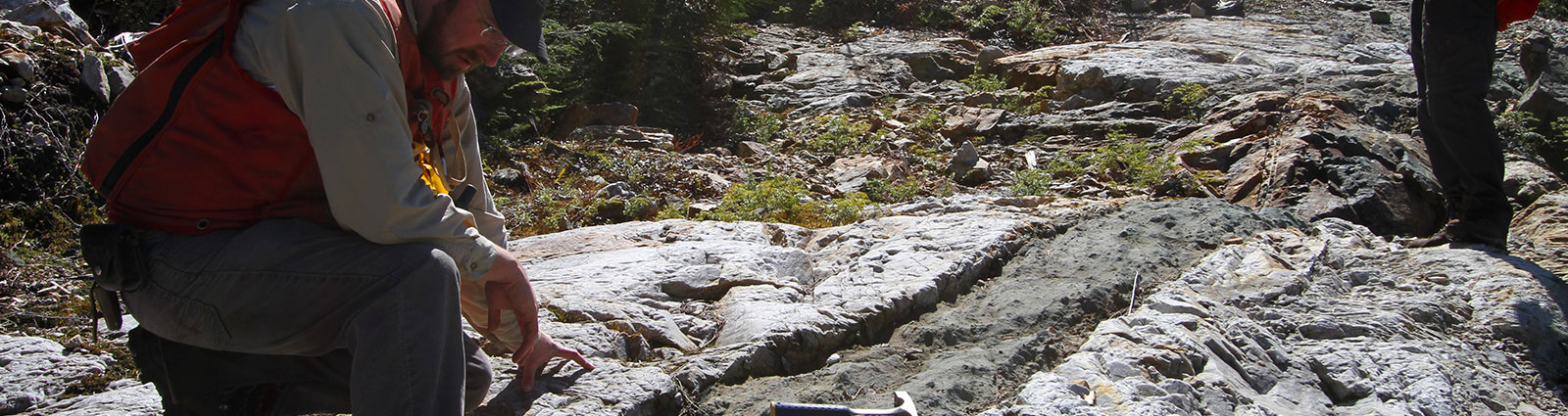
Over the course of 4 weeks, field crews completed 110km of Beepmat grid, 62 line kilometers of Mag and VLF-EM, twenty-six (26) “A” drill holes, soil sampling and preliminary outcrop mapping and sampling. The Mag and VLF-EM surveys focused on anomalously conductive zones primarily located within an offset of a southern splay of the regional Cadillac Tectonic Zone (“CTZ”).
The Beepmat, Mag and VLF-EM surveys were executed along North-South and East-West grid lines. Line spacing for Beepmat, Mag and VLF-EM was initially 200m. In both cases, secondary coverage with much tighter spacing was used to further delineate identified anomalies. Several small Mag anomalies were identified through VLF-EM and one significant anomalous zone was identified and delineated through the Beepmat survey. The large Beepmat anomaly, with a preliminary width of 20m and length of 85m, was subsequently drilled using a small diameter, backpack-mounted diamond drill.
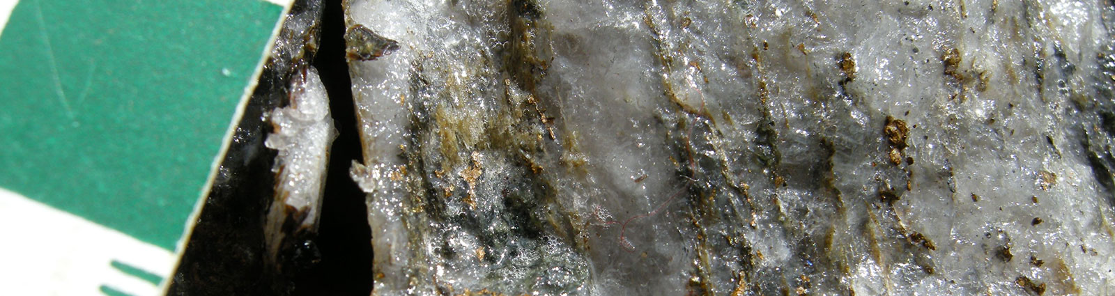
Twenty-six holes totaling 29.98m were drilled with a large variation in structure, mineralization and alteration present. The first two holes drilled into the anomaly intersected a graphitic shear zone with abundant sulphides. Twenty-five of the twenty-six holes were drilled into mafic to intermediate volcanics hosting 5-50% Pyrite and Pyrrhotite as disseminations, stringers or semi-massive to massive bands. Quartz, Sericite, Tourmaline, Ankerite and Epidote alteration of varying intensities were identified in nearly all drill holes. Thirty seven (37) drill core samples were collected and sent to lab for geochemical analysis with results pending. Results from the VLF-EM and Mag survey have been sent for processing and analysis to a geophysicist registered within the Province of Quebec; results and interpretations are expected within the next few weeks.
Fourteen (14) soil samples were also collected using the backpack drill to ensure soils were collected below the moss cover at surface. The soil samples were taken at an average depth of 2m and subsequently sent for analysis along with the drill core samples. The soil samples were collected from swamps in the southern section of the claims and are part of a larger soil sampling grid planned for later in the year. Due to the presence of the swamp, it was decided that sample collection would be best completed while the ground was still frozen, as sample collection later in the season during the second phase of exploration would have been difficult. Preliminary mapping and sampling were conducted simultaneously with the geophysics surveys in locations where rock outcrops could be seen above the snow. Several outcrops were mapped and sampled and analytical results for these samples are also pending.
President Clive Massey commented, “The board is very pleased with the results of this important baseline work, which successfully indentified and then immediately investigated geophysical anomalies with short hole drilling.”
New maps and visualizations of Aldever’s Lac Villebon Project and compilation maps of this program can be viewed at www.aldever.com.
About the Lac Villebon Project
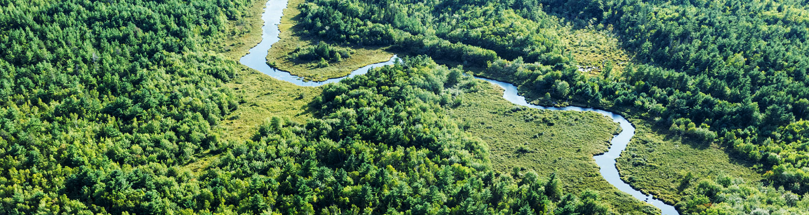
The Lac Villebon Gold project covers an area of approximately 855 hectares on the western shore of Lac Villebon, and the Project’s mineral claims are contiguous with the southern border of Alexandria Minerals’ Cadillac Break Property Group. The Project is 31 kilometers southeast of the historic Sigma and the Lamaque Mines, which are currently controlled by Integra Gold Corp. and produced ~ 9.1M oz Au*. The Lac Villebon Gold Project is also ~18km southeast of Agnico Eagle Mines Limited’s Akasaba West Mine, which was acquired from Alexandria Minerals Corporation in 2014 and hosts an indicated gold resource* of approximately 200,000 oz Au. Other active companies in the immediate area include Glencore (GLNCY), 1.5km to the south, and Monarques Gold Corporation (MQR-V) and Cartier Resources Inc. (ECR-V) to the northeast. The project is easily accessible year-round by the Trans-Canada Highway and is a 40 minute drive from the city of Val-d’Or.
*These estimates of gold production and resources are sourced from publically available materials from other companies active in the Val’ d’Or Mining Camp and are not located on the Lac Villebon Property Aldever has not undertaken any independent investigation of the production/resource estimates nor has independently analyzed the publically available results.
The technical contents of this news release have been reviewed by Abby Peterson, P. Geo. Ms. Peterson is registered in the Province of Quebec, is a Qualified Person as defined by NI 43-101 and has approved this news release.
For further information, please contact:
Clive Massey, President
Aldever Resources Inc.
Phone: (604) 644-6794
Neither the TSX Venture Exchange nor its Regulation Services Provider (as that term is defined in the policies of the TSX Venture Exchange) accepts responsibility for the adequacy or accuracy of this release. Statements included in this announcement, including statements concerning our plans, intentions and expectations, which are not historical in nature are intended to be, and are hereby identified as, “forward‐looking statements”. Forward‐looking statements may be identified by words including “anticipates”, “believes”, “intends”, “estimates”, “expects” and similar expressions. The Company cautions readers that forward‐looking statements, including without limitation those relating to the Company’s future operations and business prospects, are subject to certain risks and uncertainties that could cause actual results to differ materially from those indicated in the forward‐looking statements.